Earthquakes
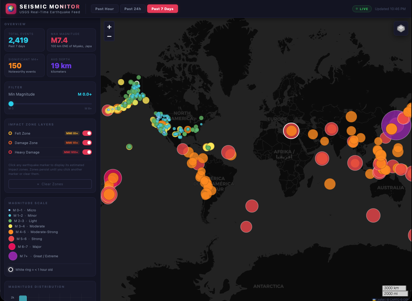
An interactive visualization of recent earthquake events from the USGS live feed, allowing users to explore seismic activity worldwide.
A collection of interactive mapping demonstrations showcasing spatial data, custom cartography, and web GIS capabilities.
An interactive visualization of recent earthquake events from the USGS live feed, allowing users to explore seismic activity worldwide.
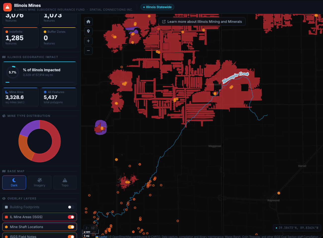
A spatial record of historical mining operations across Illinois, mapping locations, types, and operational history of the state's mineral extraction industry.
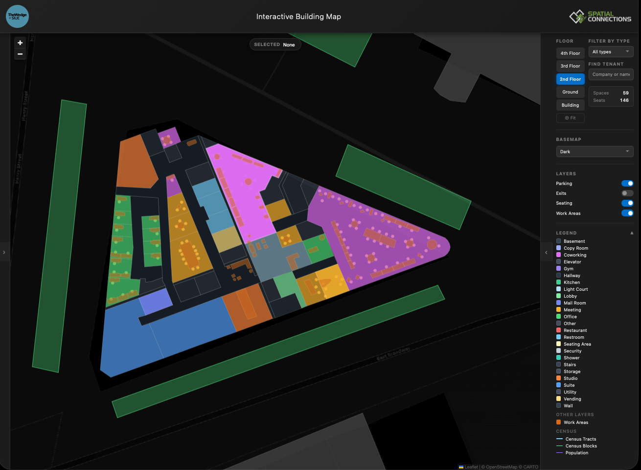
An interactive look at The Wedge building that allows users to explore the different floors and spaces as well as the surrounding area.
We build interactive web maps tailored to your data and goals.
Get in touch